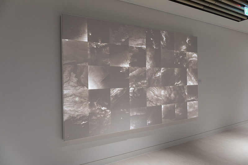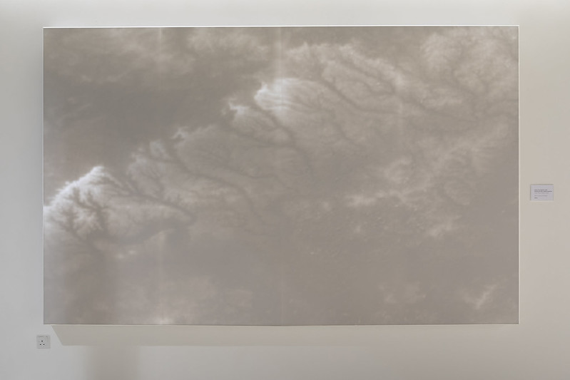
White Corian and LED lights

White Corian and LED lights
173 H x 157.5 W cm.
Italy.
About the artist

Giulia Cacciuttolo
I was awarded this commission in 2018 after a process of selection which lasted several months. From the very first brief, my interest lay in communicating the idea of a borderless network specifically related to DLA Piper’s global/localconcept. I decided to base my concept on sand migration patterns; sand embodies these concepts very efficiently, by being able to migrate between countries across the world. Moreover, sand is an element present in almost any kind of soil around the world, transmitting the idea of a global network with a strong identity.
The process behind the realisation of the two murals has been very challenging but incredibly rewarding both personally and professionally and without the precious help from Cutting Edge and Alessio De Mitri, design engineer, they would have never been accomplished.
Starting from the concept expressed above, I worked and researched in order to translate it into two Corian murals. I started my research on sand migration patterns and their evolution and found studies that were using satellite images to trace sand migration over periods of time. I discovered a mission made by NASA between 2008 and 2010 called the Space Shuttle Radar Topography Mission (SRTM). During its 11-day mission, the space shuttle Endeavour orbited the Earth 16 times; as part of this mission, it captured Earth’s topography at 1 arc-second (30 meters) for over 80% of the Earth’s surface. Using synthetic aperture radar and interferometry, SRTM has collected one of the most accurate Digital Elevation Models of Earth. A Digital Elevation Model (DEM) is a digital model or 3D representation of a terrain’s surface — commonly for a planet (including Earth), moon, or asteroid — created from terrain elevation data. Subsequently, I discovered that NASA made this data open source on the USGS Earth Explorer.
I was fascinated by this technology, this research and the images that it produced and endeavoured to blend this contemporary technology, the conceptual implications behind sand, linked to DLA Piper’s founding concepts, and my contribution as an artist. Keeping in mind the importance of the global connections among DLA Piper’s offices, I picked a single city for each country in the world in which DLA Piper is present; for each city, I found sandbanks on its surface or below it and then, using USGS Earth Explorer, I obtained a DEM image of that specific spot.
Using these images, I realised the first mural - near the reception desk – which represents the global concept with its 40 modules corresponding to 40 cities in 40 countries in which DLA Piper is present. The second piece – on the 8th floor - is focused on the local aspect reproducing London’s DEM sandbank image. They are both realised in white Corian, backlit with LED lights and engraved with CNC.